Water Water Everywhere! And, Not a Drop to Grow? The Use of Irrigation Monitoring in Agriculture, Golf and More!
Leaky pipes! Bad spraying application patterns. Mistiming of automatic sprinkler schedules!
These are just a few of the potential problems that any crop consultant, farmer, golf course superintendent, municipal parks staff or others responsible for plant vegetation management will tell you will pop up with irrigation system – those complex webs of underground pipes, control boxes and overhead sprinklers.
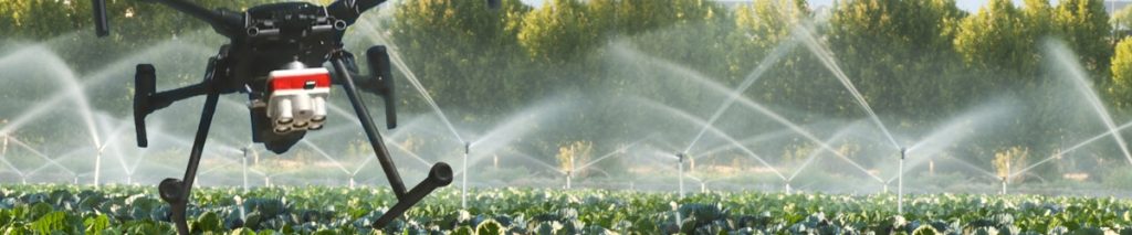
Fortunately, a sophisticated drone flyover and analysis by LI&D can help provide you with a wide range of new, low cost insight which can help you to solve your water challenges. This can become critical as global warming takes hold, water restrictions come into effect, and new technology comes to the forefront.
Consider some of the benefits:
1
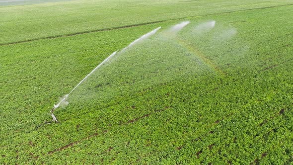
Photos and video
from above while the irrigation system is running can provide for easy identification of differences between a given sprinkler and those adjacent to it, leading to adjustment and maintenance opportunities
2
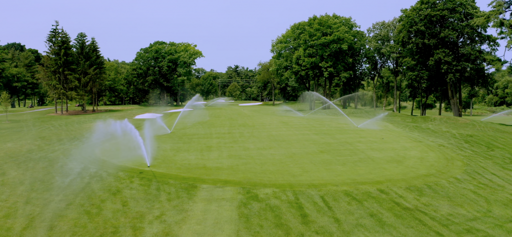
“System Uniformity Test”:
a flyover while the large scale irrigation system is running can help us spot potential problems in coverage, range and strength of the spraying
3
Rotation accuracy:
it’s possible to guage whether any of the large sprinkler heads are spinning faster than others which can also lead to inaccuracy with over or under watering
4
Flight can be programmed
for multiple angles – from straight down to slight angle – to capture in a video any other differences in the water spray for future investigation
5
Infrared camera
might also help in identifying leaks – but in a separate flight while the system is not running! This is best done at the start of the season – i.e. in the next few months – before the crops get planted or before turf starts to grow
6
Turf and crop health
analysis can also provide valuable insight on actual irrigation planning
7
Drainage issues
identified by excess water runoff and areas of standing water – particularly useful after a large rainfall event or storm
8
Drone images
can be combined with data from underground sampling, on a detailed overview map, for further analysis
9
Taking all this further,
the insight can be used for irrigation timing planning, by analyzing the impact of water application at different items of the day in different weather circumstances
Is all this worth it? Most definitely – one study suggests that what is known as ‘furrow irrigation” can cost about $11 an acre, so any opportunities to make an irrigation system more efficient can be very effective!
What does the future hold for irrigation? We are on the edge of an era of ‘smart water grids,’ with real time watering based on embedded ground sensors at each sprinkler head. We imagine a future, not too far away, in which an flyover by a drone will interact with this smart technology on a real time basis in order to adjust the spraying pattern, in real time!


Comments are closed.