“Wow, I Didn’t Know I Could Do That!” – Discovering the Potential for Drone-Based Insight With the Software Platforms You Already Have in Place!
Whenever a new technology comes along, there is often a lag time between the arrival of the technology and the comprehension that people might have with respect to what is possible.
Such is the case with drone technology! Our experience with our clients, and the many exploratory calls that we have with potential clients, demonstrates to us that there is often a significant gap in understanding what is possible – simply because the pace of drone technology is evolving so quickly.
This is particularly true when it comes to how the insight gained from a drone flyover might tie into an existing software platform that a company might already be using!
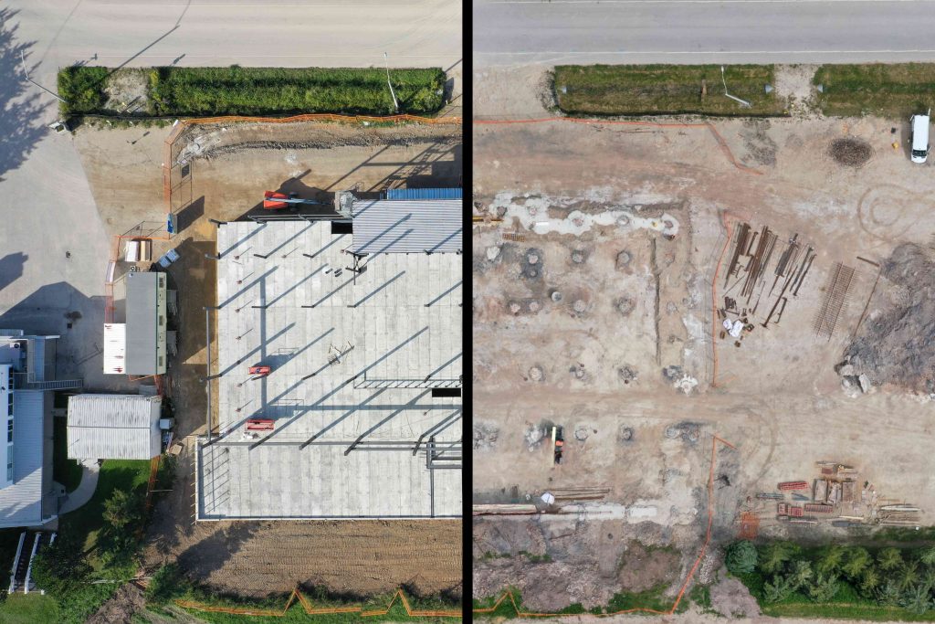
Let’s give you an example – the construction industry. We’ll start out with this image which might whet your appetite! A drone flyover can obviously capture construction site information in an entirely new and different way. It’s the ability to tie this insight into your existing platform that matters.

What’s up? Over the years, many construction companies have implemented sophisticated project management software platforms, such as Bluebeam, Procore, and PlanGrid. These programs allow for very detailed collaboration between different companies involved on complex projects, management of timelines .
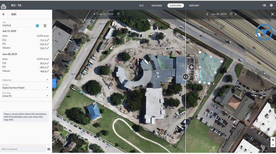
Some of the common features includes inventory tracking, site progress, equipment placement and more. If you add to that capability the opportunity for side-by-side photo comparison – that can be a very powerful tool to track the progress of construction over time.
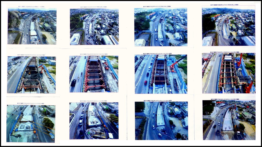
We found this image, for example, of a monorail construction project that took place in Okinawa, Japan. Such information can be used for budget and spending analysis, project timeline achievement and other project milestone insight.
That’s where drone technology comes into play – a regular series of overhead flights will capture photos that can be easily integrated into many of the construction project management programs you might already have in place and which you are actively using!
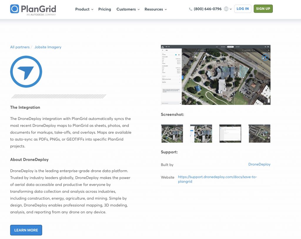
For example, the popular PlanGrid program features a plug-in module from the popular DroneDeploy drone platform which allows for easy integration of side-by-side pictures.
With this integration, it becomes relatively straightforward to introduce these side by side comparisons into the construction project management platform that you already using with your team and partners.
Side-by-side comparison is but one example – you might be pleasantly surprised to discover that there are other opportunities related to the platform that you already have in place – regardless of your industry. For example, there are similar capabilities that exist for many precision agriculture programs and platforms.
The key thing is that you need not worry about capturing the images – that’s our job at LI&D. We can also take on the role of investigating the opportunity for the project management software that you might already be using in order to give you an idea of the potential path forward!


Comments are closed.