7 Days, 7 Questions – #4 : Where Did Your Company Name Come From? And What Does it Mean?
“Where did your company name come from? What does it mean?”
We get this one a lot – most often from people who don’t grasp the revolution that is occurring with our tag line, “insight from altitude” with the using the platform of drone technology.
We at LI&D are at the forefront of a new industry that has been around for just a few years but that is just now gaining momentum – that of being able to increasingly analyze and interpret all aspects of the world around us through spatial, location oriented insight.
That’s a mouthful, but let’s put it in more concrete terms based on a statistic we saw yesterday in an article in Chinese People’s Daily:
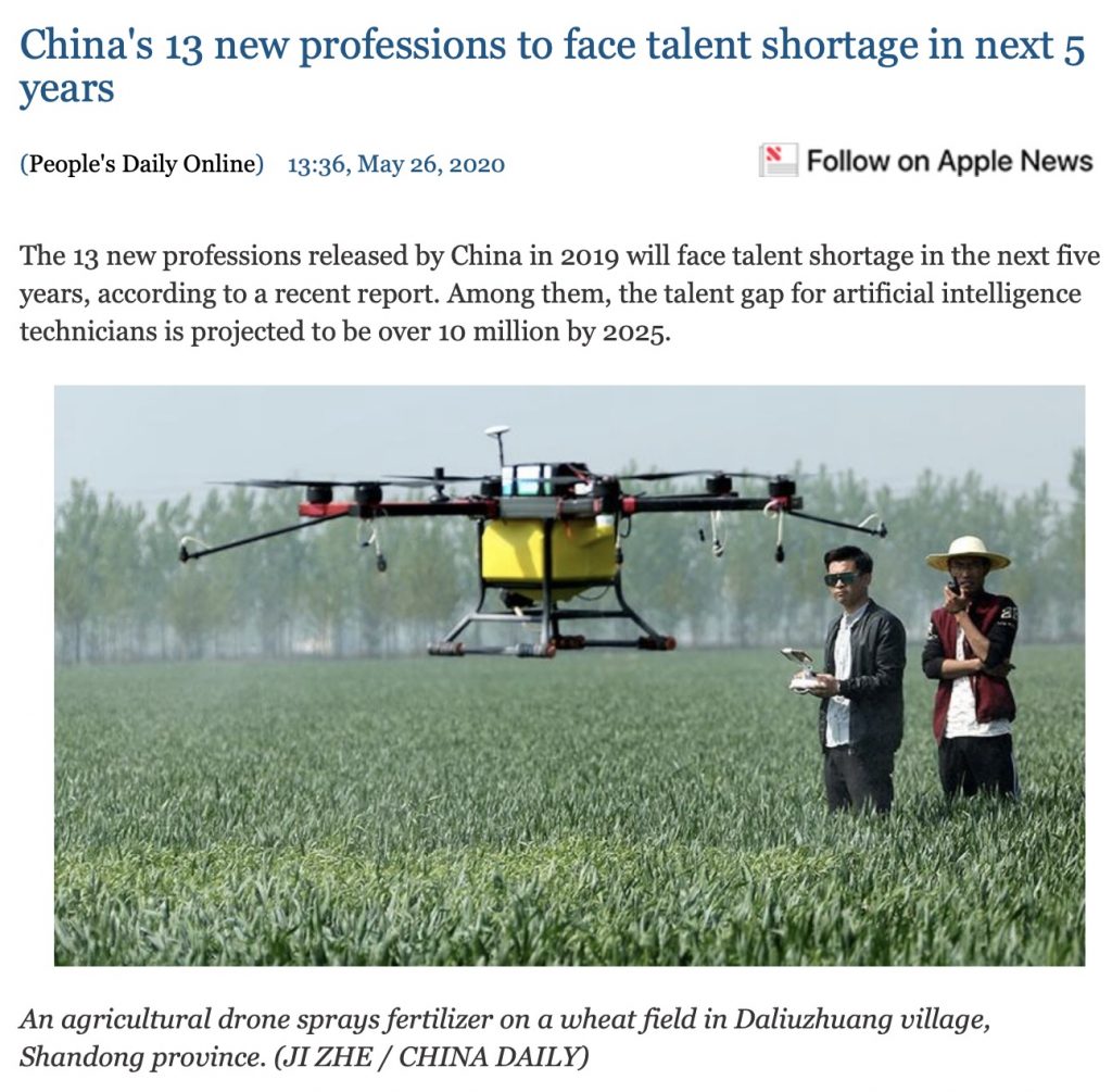
One of those careers? Drone pilots – with an estimated shortage of 1 million people in the profession in China! We can expect similar issues worldwide as businesses and industries discover the power of the insight from altitude.
So what does it mean? The first part of our company name, “Location Intelligence,” is perhaps the easiest to grasp. Essentially, we’ve entered into a world in which we now have all kinds of new digital information – or intelligence – on specific locations or areas of location – that can be gathered from up above and then analyzed for further insight.
Location intelligence (LI), or spatial intelligence, is the process of deriving meaningful insight from geospatial data relationships to solve a particular problem.[1] It involves layering multiple data sets spatially and/or chronologically, for easy reference on a map, and its applications span industries, categories and organizations.
Wikipedia
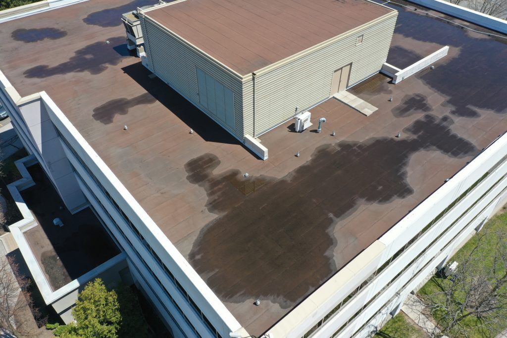
Location intelligence? Think of precision farming via drone – a flyover can help us determine disease, plant stresses and crop health on a very discrete basis, often down to a sq. cm level. Or mapping of city streets – the information can be analyzed for traffic patterns and traffic flow. Or industrial building flyovers – intelligence on damage, wear and tear, heat spots and other insight.
Essentially, once we put an ‘eye in the sky,’ we can analyze and interpret the world around us in a different way.
Is the concept new? Not at all! Location intelligence has been around us for quite some time – first via plane during and leading up the Second World War, then via satellite with the launch of the space race, leading to initiatives like Google Earth and other online mapping technologies.
Every day you are living in a world of location intelligence – it’s in the mapping technology in the car you drive, the phone you carry around, the pictures you encounter on the Web. Throughout the history of this blog, we’ve been busy outlining the massive new business opportunities that come from location intelligence.
The key issue is that the aerial part of drone technology really accelerated location intelligence because of the massive increase in image resolution and the sophistication of the analysis tools. Obviously, it’s a far different thing to gain insight from a few meters above the ground compared to a hundred kilometres or more!
The second part of our company name, “Design,” which helps to differentiate us from those who are simply drone partners and pilots. Our key skill is analyzing, interpreting and processing the information that we can from up above with very sophisticated analysis tools.
Our main skill sets included the science of physical geography; detailed digital mapping capabilities; scientific analysis and interpretation. We help you to ‘design’ your future actions based upon the location oriented digital insight from altitude that we can obtain from our drone flyovers!
In other words we don’t just fly the drone – we tell you what the information we gain means!
And so there you have it!
Keep those questions coming!


Comments are closed.