Like any industry, the drone industry is seeing fast emergence in new participants. Keeping up with the changes keeps us on top.
All posts by Willie
The hardest part of starting up is starting out.
Here’s a Word: Homologation. And We Can Help You with That Too!
We at LI&D can utilize our drone and mapping technology to help you with your homologation requirements.
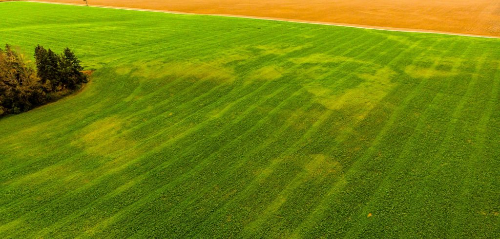
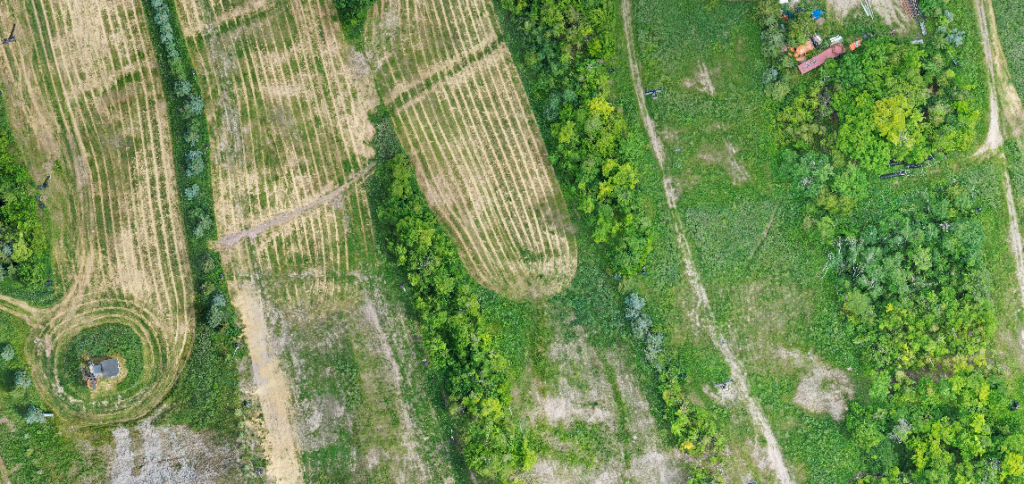
The Future of Drones in Agriculture – Unlimited Only By Your Imagination!
According to some estimates, the agricultural drone industry will be worth more than $1 billion by 2024.
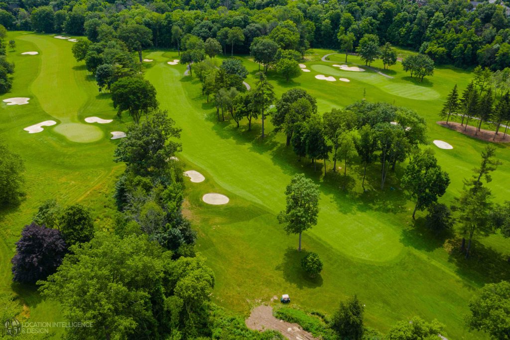
Golf Insight From Above – Willie Carroll, C.E.T. to Speak at the Upcoming Canadian Golf Course Superintenddants Assocaiton annual conference!
Have you been hearing about new methods of analysis for your golf course using sophisticated mapping tools and want to learn more about it? With advanced drone mapping technology, you now have the chance for extremely complex analysis at a very low cost.
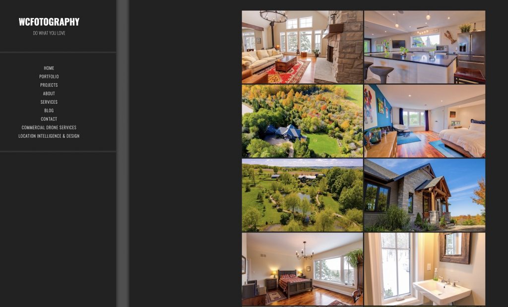
Check Our Creative Services Section- Such as Real Estate Photography!
Photography & Videography. Another great service that LI&D can provide to give a different perspective to your projects.
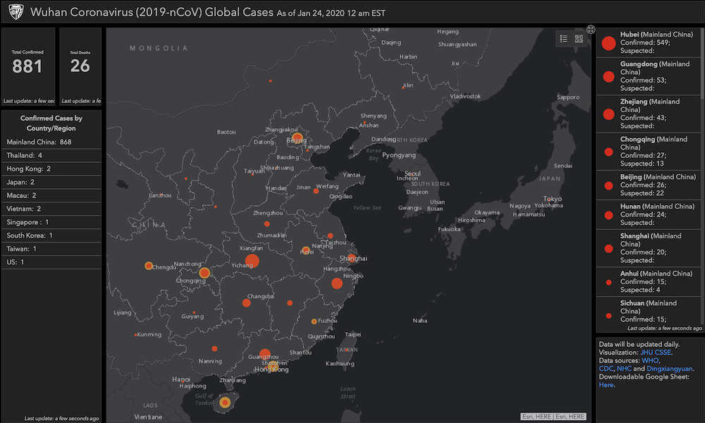
Tracking the Coronavirus via GIS – The Power of Map Based Insight for Epidemic & Disaster Management
The world is warily watching the rapid emergence of a new global health risk in Wuhan and other Chinese cities.
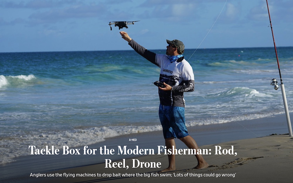
Drones for Fishing? Yes, It’s a Thing. So Are These Other Unique Trends with Drone Technology!
We are continually tracking new developments and trends with drone, mapping and geospatial technologies in order that we can provide our clients with the latest insight and opportunities.
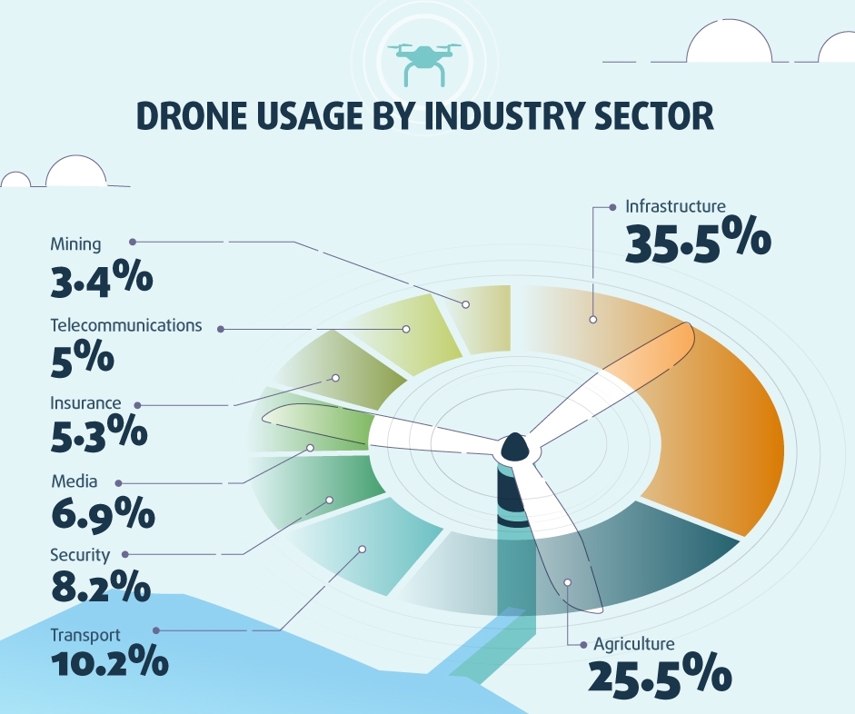
Are You Thinking “Location, Intelligence?” The Revolution that is Aerial Drone Insight!
Many industries are not yet thinking about the vast opportunities that from from location intelligence.
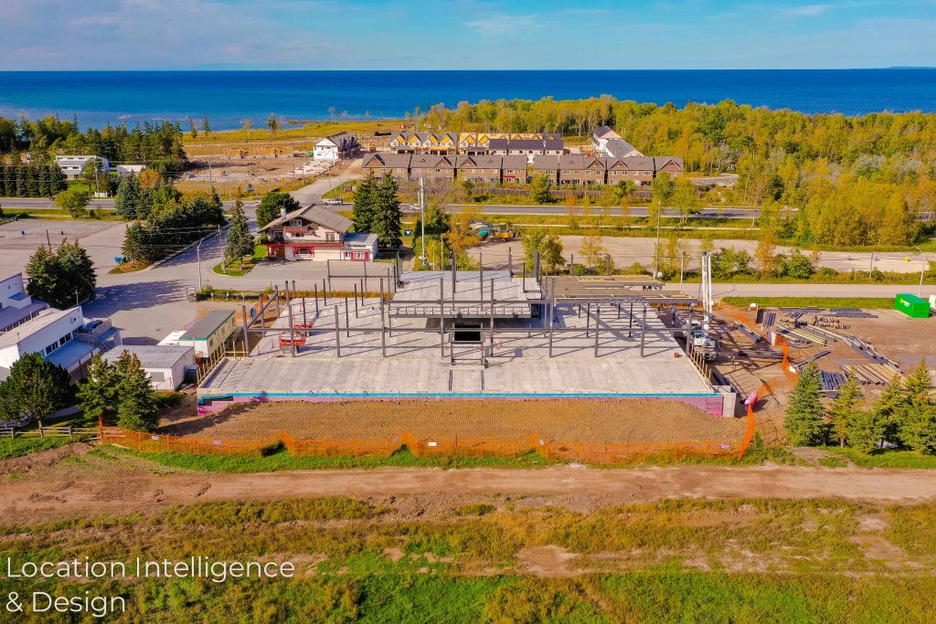
“What’s the Status?” – How Drone Based Visual Insight Can Help You with Your Construction Project Management
It’s the phrase that every construction project manager hates to hear – “What’s the status? Are we falling behind?”
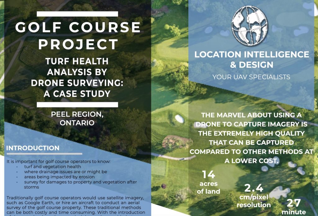
You Might See Winter! We See Opportunities in the Golf Industry with Aerial, Drone Based Insight!
Golf course superintendents live and breath green grass. Why not add an extra tool to help assist with assessing turf health issues.


