We are excited to announce another one of our articles has been published. This time in GreenMaster, the official publication of the Canadian Golf Course Superintendents Association.
Currently browsing: Science
The hardest part of starting up is starting out.
Turf & Rec Publishes Our Article: “Drones & Turf: Monitoring Health of Green Spaces”
“Drones & Turf: Monitoring Health of Green Spaces.” We have been featured in the Turf and Rec publication, which serves the Canadian turf and grounds maintenance industry.

The Plateau of Productivity: Why The Opportunity for Insight from Altitude Is Here NOW!
Like any new technology, drone tech has gone through the hype, the hysteria, the disappointment, and then the inevitable realization as to the role that insight from altitude can play in so many industries. Find out how this inevitable cycle has shaped how we use drones today.
That “Vision” Thing: The Many Different Eyes-in-the-Sky on The Drones Up There – And What It Means for You!
The capabilities of drones is only limited by the type of sensors or cameras available to use. That being said, we outline a few uses of different cameras and sensors that can be mounted on to a drone.
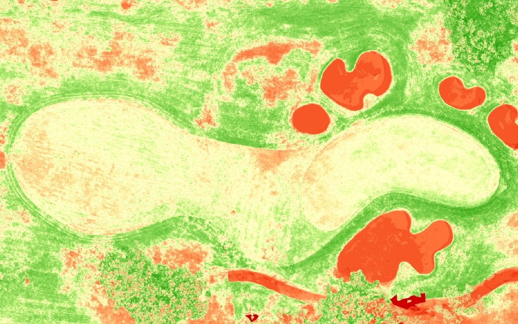
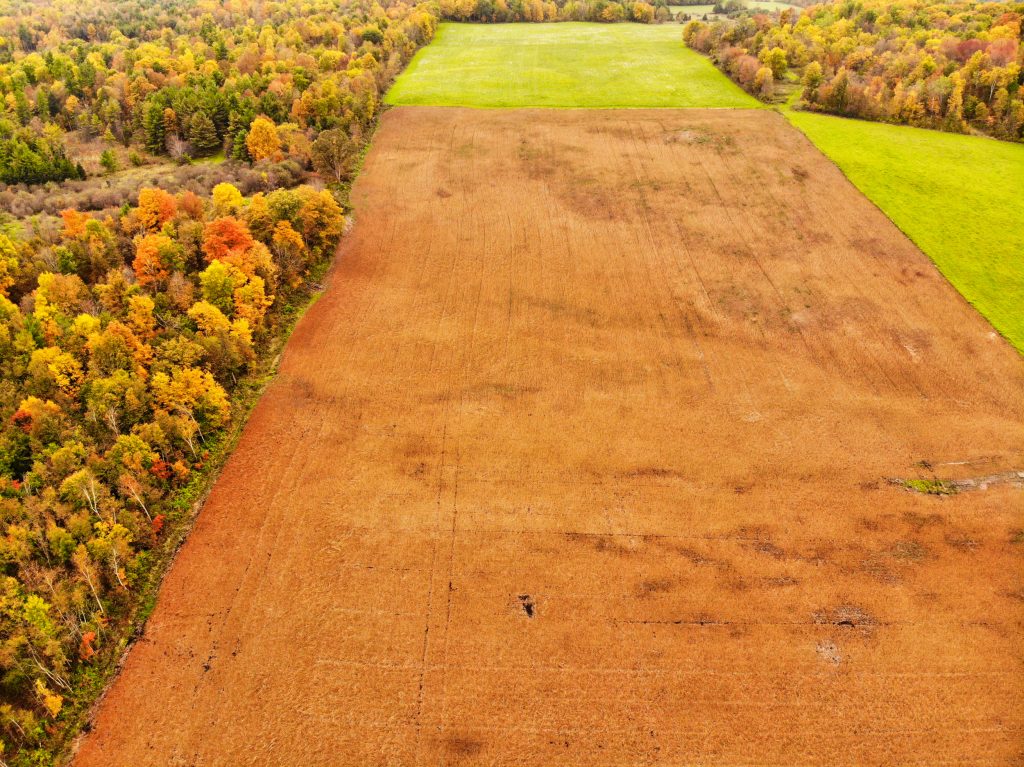
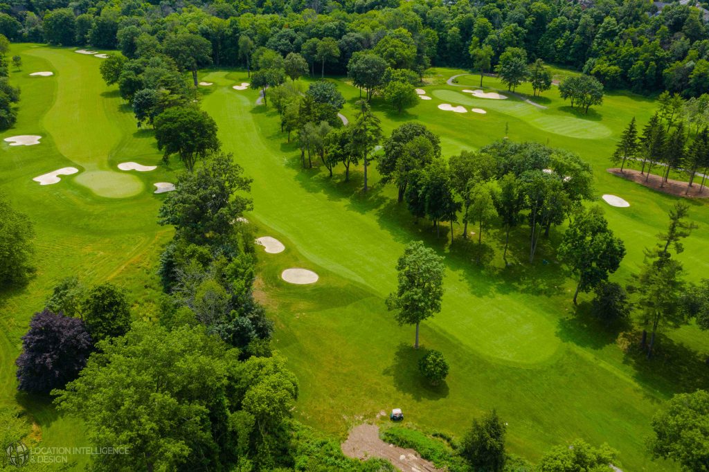
Soaring Above: Providing Unique Insight Into Golf Course Turf Management – Our Talk to the Canadian Golf Superintendents Association Today!
Using drone technology for golf course maintenance does not make maintenance staff redundant, rather it is an extra tool to make their efforts more efficient and cost effective.

Can You Dig It? Looking Back by Looking Down at What is Hidden in Plain Sight – The Exciting Role of Drones in Archeological Research!
Providing a view into what was once there, drones are allowing for archaeologists to discover previously unseen ruins or artifacts.
Golf Insight From Above – Willie Carroll, C.E.T. to Speak at the Upcoming Canadian Golf Course Superintenddants Assocaiton annual conference!
Have you been hearing about new methods of analysis for your golf course using sophisticated mapping tools and want to learn more about it? With advanced drone mapping technology, you now have the chance for extremely complex analysis at a very low cost.
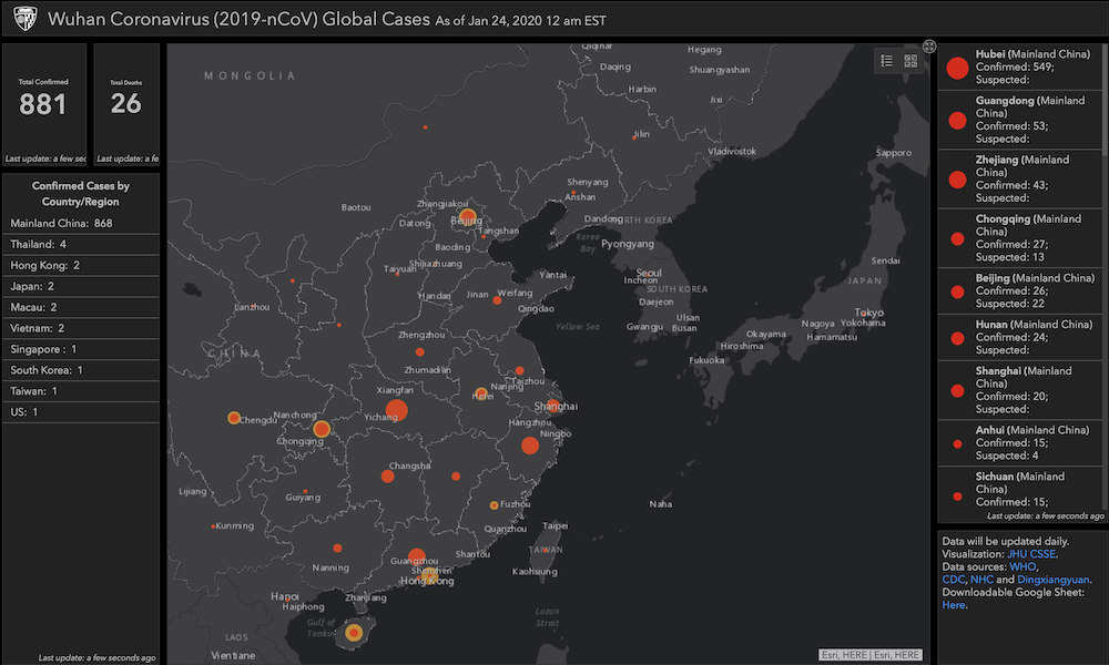
Tracking the Coronavirus via GIS – The Power of Map Based Insight for Epidemic & Disaster Management
The world is warily watching the rapid emergence of a new global health risk in Wuhan and other Chinese cities.
“Insight At Altitude” – How We Can Accelerate Your Business Operations!
The arrival of drone technology is changing the very nature of the insight that business organizations can have into their operations.


