Key information for land development for subdivisions is not about having too much information, it’s about having the right information at the right time.
Currently browsing: Construction
The hardest part of starting up is starting out.
Big Infrastructure Insight from Altitude : 10 Industries in 10 Days – What You See, What We See!
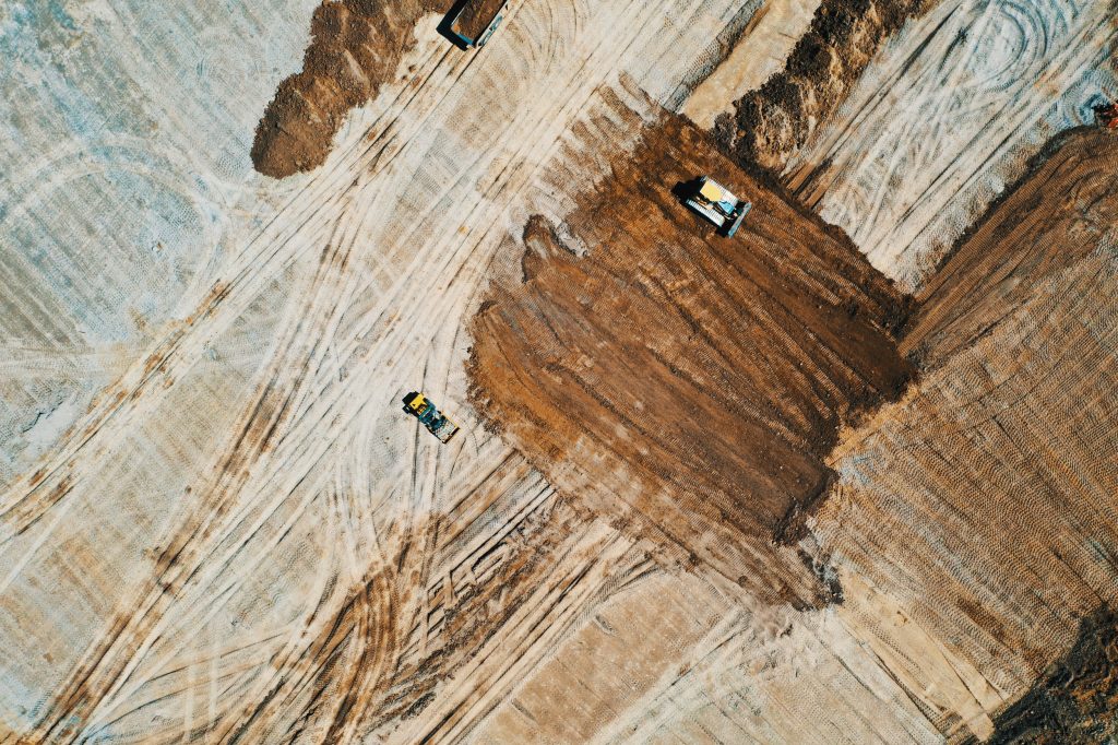
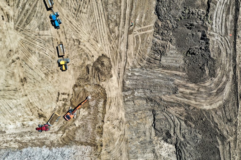
Any infrastructure project involves big money and big project management. Drones provide a new bird’s-eye into the status and progress of these projects allowing for new opportunities.

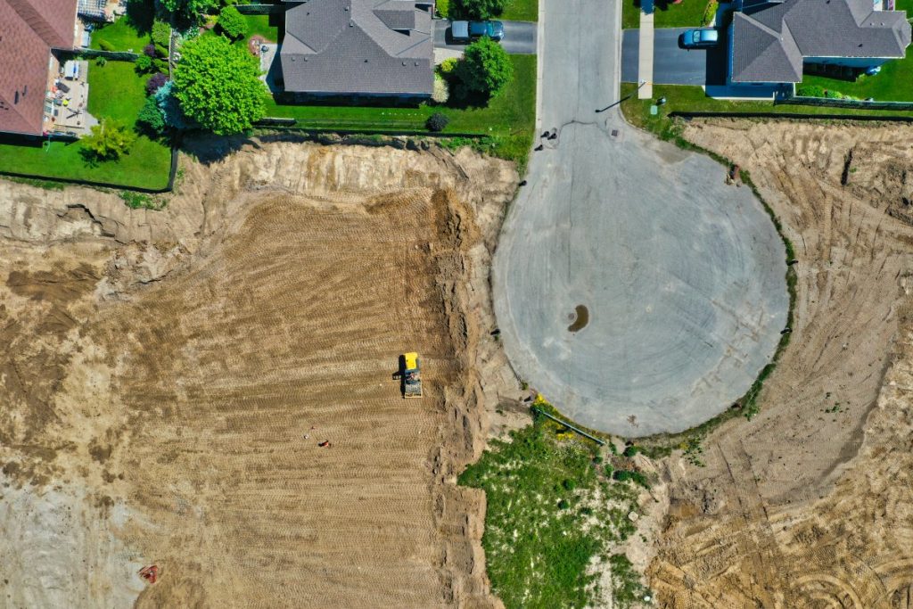
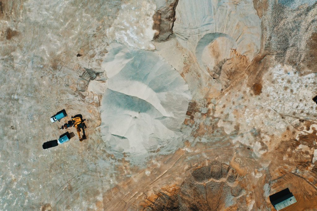
Construction Insight from Altitude : 10 Industries in 10 Days – What You See, What We See!
In the world of construction, drones are becoming key tools found on project worksites. Find out how using a drone could benefit you.
Our Upcoming “Benefits” Series: 10 Industries – 10 Opportunities!
Over the next two weeks we will be taking a deeper dive into 10 industries and how drones can have opportunities and benefits within projects in these industries. Stay tuned for more updates.
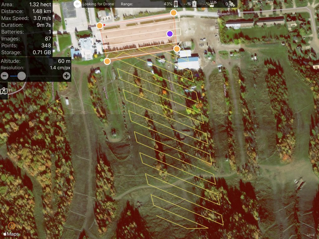
Flight planning : An Overview of the Process Before We Fly!
Ever wonder how drone operators conduct some of their flights over different areas? It’s all about the pre-flight work and the autonomous flight planning that make these kind of flights possible.
The ROI From Drones and The Opportunity of Insight from Altitude: Better, Faster, Cost Effective!
With new technology there is always a learning curve for it to become common place. Drone technology is slowly starting to become more prevalent within many industries. Read some of our insight on how drone technology can help you in your industry.
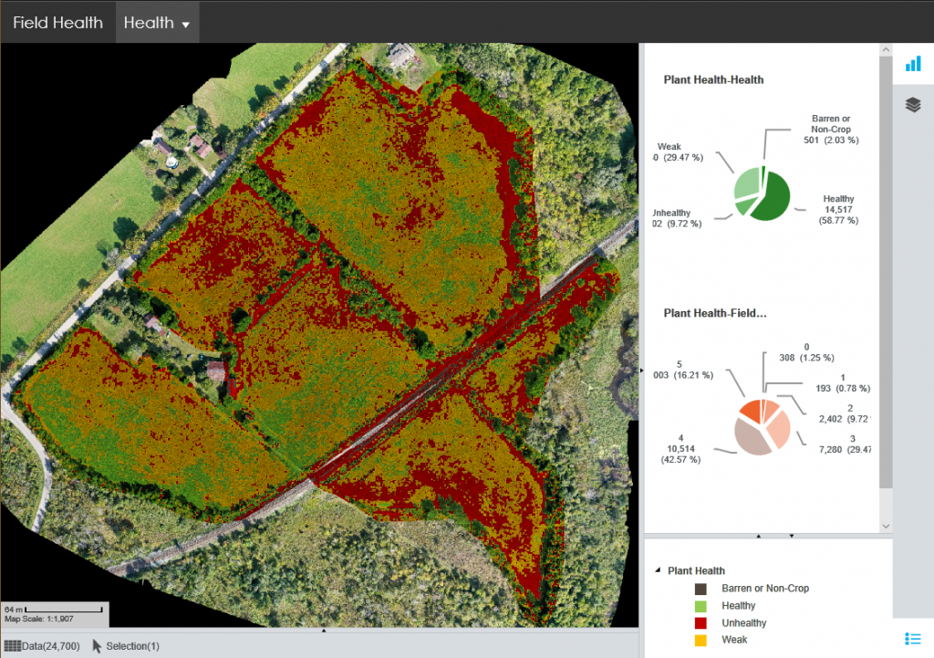
The Flight Path: Raw Data to Actionable Information – How We Get You Visual Insight from Altitude!
How do we fulfill our prime directive of interpreting information that we collect from our drone flights? Find out how we deal with all that data.
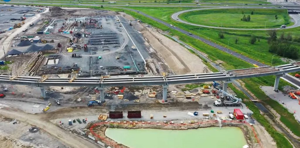
Big Infrastructure? Big Challenges! Big Opportunities!
Large scale infrastructure projects are a critical component for the economic success of a region. Companies are recognizing how the use of drones can provide useful information and insight for successful community outreach and public relations strategies to maintain public approval.
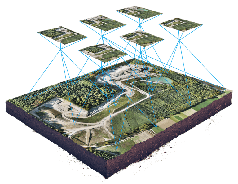
That’s One Big Picture – But One With a Lot of Insight! Understanding the Magic that Comes from Drones, Photography and GPS Insight
In some ways, the arrival of drone technology is a lot like the early days of the emergence of e-mail: people know that it is out there, but aren’t quite sure what they can do with it. Years later, it has become indispensible to every single aspect of their business operations.
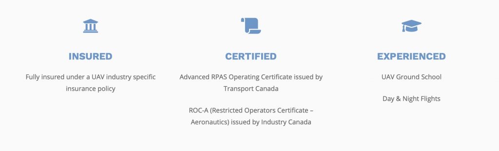
Drone, GIS & Mapping Insight – Professional Skills Matter : We’re Insured, Certified, Experienced!
Like any industry, the drone industry is seeing fast emergence in new participants. Keeping up with the changes keeps us on top.


