Any infrastructure project involves big money and big project management. Drones provide a new bird’s-eye into the status and progress of these projects allowing for new opportunities.
Currently browsing: Mapping
The hardest part of starting up is starting out.
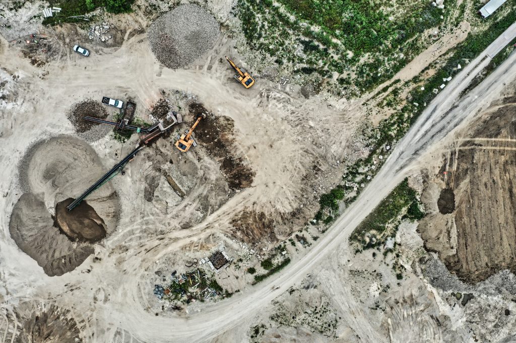
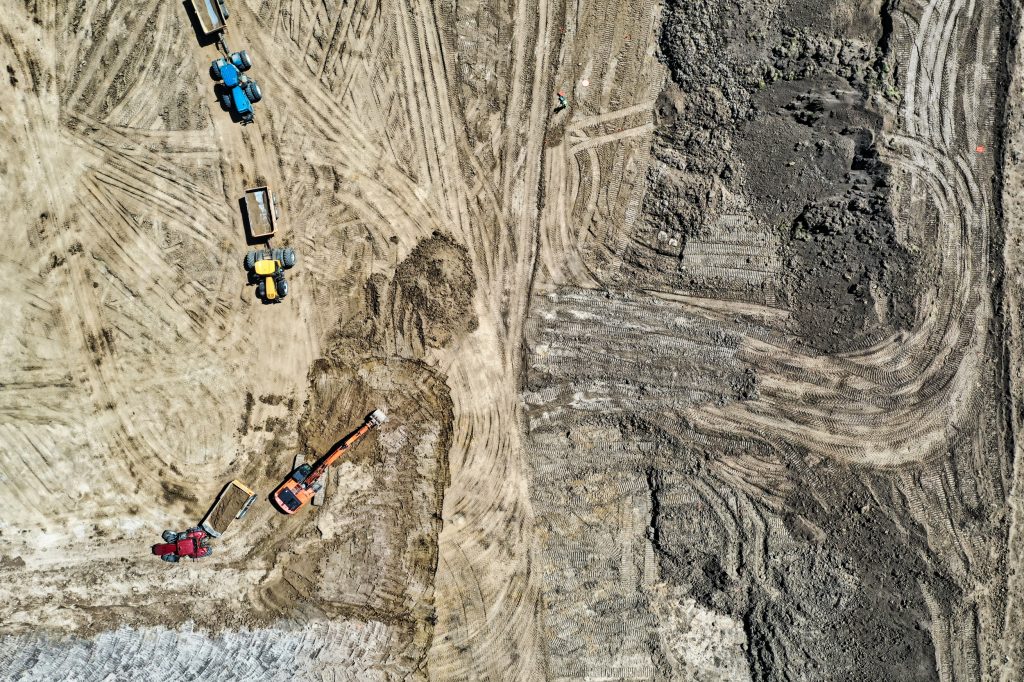
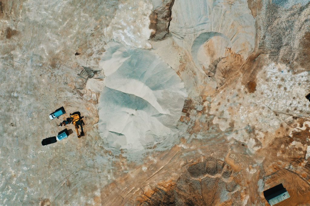
Mining and Aggregate Insight from Altitude : 10 Industries in 10 Days – What You See, What We See!
Ready to rock on? Drone technology is changing the way that the mining and aggregates industry are operating on a day to day basis.
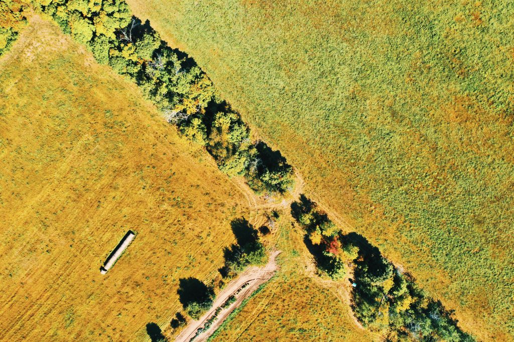
Agricultural and Farming Insight from Altitude : 10 Industries in 10 Days – What You See, What We See!
Drones are opening up a whole new window in the world of agriculture. Providing precision data, farmers are making better decisions based on the health of their crop.
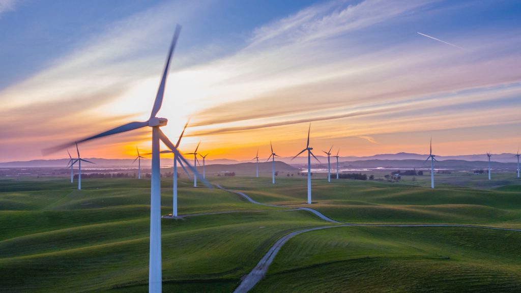
Electrical and Renewable Utilities Insight from Altitude : 10 Industries in 10 Days – What You See, What We See!
The arrival of drone technology is changing how utilities are conducting inspections and completing work. Learn how drones can be a benefit.
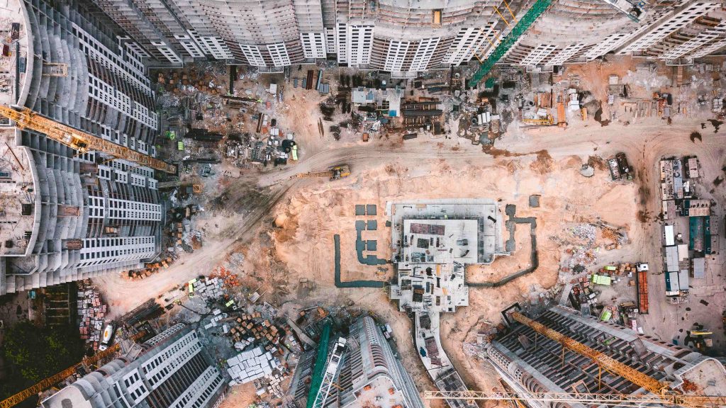
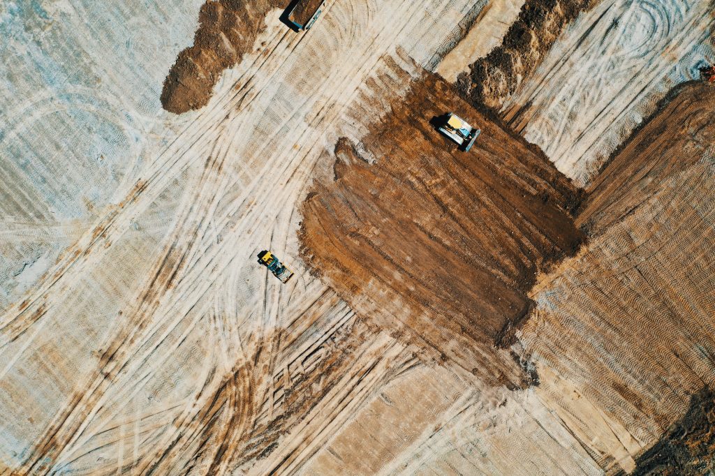
Construction Insight from Altitude : 10 Industries in 10 Days – What You See, What We See!
In the world of construction, drones are becoming key tools found on project worksites. Find out how using a drone could benefit you.
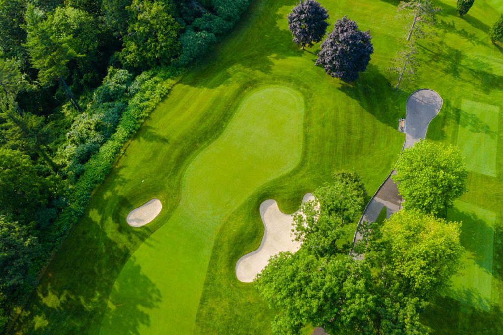
Golf Insight from Altitude : 10 Industries in 10 Days – What You See, What We See!
A drone can be a powerful tool for a golf course to provide a different perspective for marketing material and for use with course management. Here is a short overview of key benefits that insight from altitude can give to golf courses.
Our Upcoming “Benefits” Series: 10 Industries – 10 Opportunities!
Over the next two weeks we will be taking a deeper dive into 10 industries and how drones can have opportunities and benefits within projects in these industries. Stay tuned for more updates.

Location Intelligence & Covid-19 : The Powerful Insight of GPS Based Mapping Information
Online maps are become increasingly popular to track the spread and to show the clustering of COVID-19 cases. Behind each of these online maps is a complex system that is used to gather, visualize and share the data to the public.
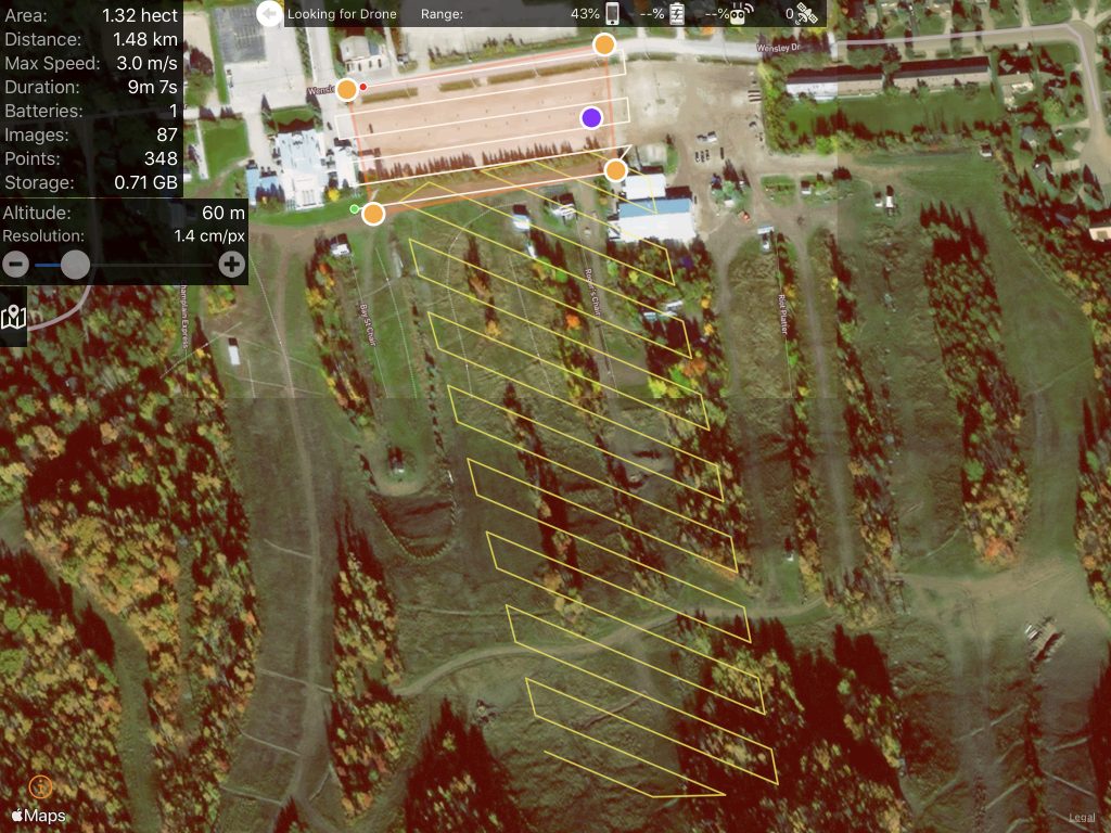
Flight planning : An Overview of the Process Before We Fly!
Ever wonder how drone operators conduct some of their flights over different areas? It’s all about the pre-flight work and the autonomous flight planning that make these kind of flights possible.
The ROI From Drones and The Opportunity of Insight from Altitude: Better, Faster, Cost Effective!
With new technology there is always a learning curve for it to become common place. Drone technology is slowly starting to become more prevalent within many industries. Read some of our insight on how drone technology can help you in your industry.


